At least 130,000 acres (52,609 hectares) of rich, bottom farmland were sacrificed by the U.S. Army Corps of Engineers this week by blowing a two-mile hole in the Birds Point levee (three blasts in three days) in Southeast Missouri to protect the town of Cariro, Illinois, population 2831. It will take many months for the land to dry out, with some permanent damage expected. Add to this event many decades-worst flooding events from North Dakota, Ohio, and other regions this past month.
Because of a cool and wet spring in the Midwest this season, corn planting is far behind schedule with 8% of Iowa planted compared to 82% last year, 10% of Illinois corn is planted, 15% of Nebraska's, 1% of Wisconsin's, Minnesota's, and Ohio's, and 2% of Indiana's. It has been said by many experts assessing our dangerously low (sub-5%) corn stocks-to-use ratio that we will need a season of "perfect weather" for this not to end badly. Could this year's weather trigger a change in our unrealistic biofuels stated goals and corn ethanol policy coming out of Washington?
NOAA's map below shows up-to-date flooding regions in red:

Next, is a series of photos taken by the US Coast Guard on April 26, 2011 of the Cairo to Bird’s Point, Missouri area spanning 30 miles.


~~~~~~~~~~~~~~~~~~~~~~~
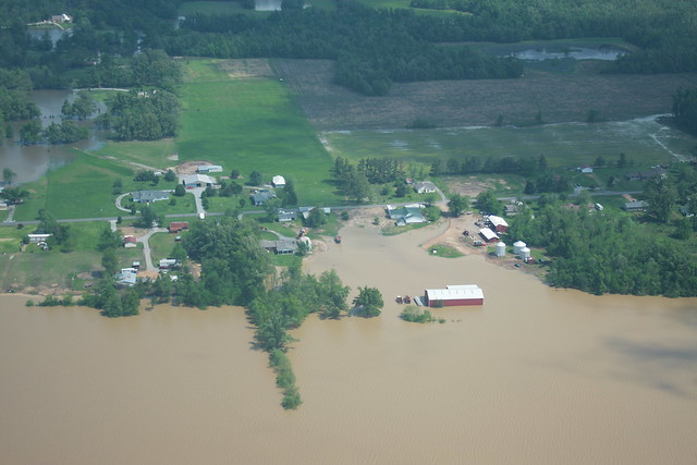
photo: flickr - April 26, 2011 - Western Kentucky
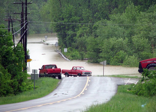
photo: flickr - May 2, 2011 - West Paducah, KY
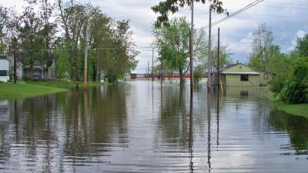
photo: flickr - April 27, 2011 - Ohio River in Metropolis, Illinois
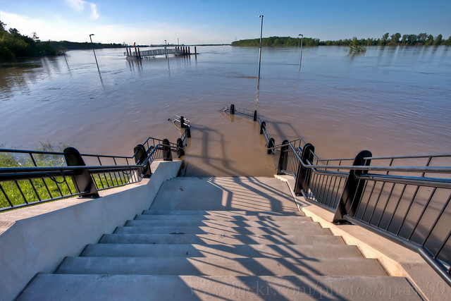
photo: flickr - April 29, 2011 - English Park in Owensboro, Kentucky

photo: flickr - April 18, 2011 - Valley City, North Dakota
Because of a cool and wet spring in the Midwest this season, corn planting is far behind schedule with 8% of Iowa planted compared to 82% last year, 10% of Illinois corn is planted, 15% of Nebraska's, 1% of Wisconsin's, Minnesota's, and Ohio's, and 2% of Indiana's. It has been said by many experts assessing our dangerously low (sub-5%) corn stocks-to-use ratio that we will need a season of "perfect weather" for this not to end badly. Could this year's weather trigger a change in our unrealistic biofuels stated goals and corn ethanol policy coming out of Washington?
NOAA's map below shows up-to-date flooding regions in red:
Next, is a series of photos taken by the US Coast Guard on April 26, 2011 of the Cairo to Bird’s Point, Missouri area spanning 30 miles.
~~~~~~~~~~~~~~~~~~~~~~~
photo: flickr - April 26, 2011 - Western Kentucky
photo: flickr - May 2, 2011 - West Paducah, KY
photo: flickr - April 27, 2011 - Ohio River in Metropolis, Illinois
photo: flickr - April 29, 2011 - English Park in Owensboro, Kentucky
photo: flickr - April 18, 2011 - Valley City, North Dakota